Tutorial – 3D Street Creation
For Community Advocates to Professionals

When it comes to redecorating a room in my house or choosing a rug or a picture for the wall – or just about anything – I rarely can imagine the outcome that others around me suggest I should do. My general inclination in response is to not bother with a change, that what I have now is good enough and not worth the risk. Thankfully, I have come to trust a few people in my life who can see these types of proposed changes and if they say I should give a thumbs-up to a design idea, then I give a thumbs-up. And in the end, I am almost always happy to have said ‘yes’ and never has a change like this been worse than the previous status quo.
When it comes to re-imagining streets that work better for people on bike (and foot and transit and scooter and wheelchair), I am in the small minority of people who can see how changes can help make a community better. It’s not a super power – I’ve studied the topic a lot and I have traveled specifically to learn about better street designs. Most people, from my experience, have as much of a hard time re-imagining a street as I do re-imagining my living room. But, where my home decor design limitations really only impacts me, our collective inability to see redesigned street ideas – which tends to lead to opposition to change – really diminishes so many aspects of our individual and shared community lives. If you care about climate change, household affordability, public health, social trust, individual freedom, using taxpayer dollars efficiently, and so much more, then you really ought to care about significantly redesigning our streets so that we get much more public benefit out of this public land than we currently do.
Therefore, having the ability to easily visualize and communicate street redesign ideas is key to helping a greater swath of the public, decision makers, and local government staff get a full grasp of why and how a new design may work. Without good visualization tools, it is hard for many people to ‘see’ a design, and if we can’t really grasp a concept the likelihood we will support it are slim.
Which is all a multi-paragraph way of introducing you to 3DStreet – a fun new tool to help design and communicate street redesigns in 3D, without the need for sophisticated computer design skills. The easiest way to use this tool is to create a free account through their web site and a free account with Streetmix, a free 2D street design tool. (If you have a University of Oregon email address and it is the 2024-25 academic year, signing up for a free 3DStreet account will automatically upgrade you to the PRO version, which allows you to embed your street designs into Google Street View and other map base layers).
And thanks to Charlie Johann, who is working with the University of Oregon’s Sustainable City Year Program and the City of Silverton (Oregon) as a Resource Assistance for Rural Environments (RARE) member, you can get a whole tutorial on how to use 3DStreet by watching this video:
Other 3DStreet Resources Include:
There is some great documentation of 3DStreet, including explainer videos and text descriptions here: https://www.3dstreet.org/docs/
Additional features regularly get announced on the 3DStreet LinkedIn page: https://www.linkedin.com/company/3dstreet
Marc’s YouTube videos on Augmented Reality street design includes one that mirror’s today’s training:
Have fun creating! I’m currently working on 3D visualizing a neighborhood filtering scheme that University of Oregon LiveMove students created in plan view last year (their work is awesome - you should check it out, especially those in Eugene) and will share along the way as it does get fairly complex when doing multiple streets and intersections, while simultaneously making some fairly bold design ideas as well.
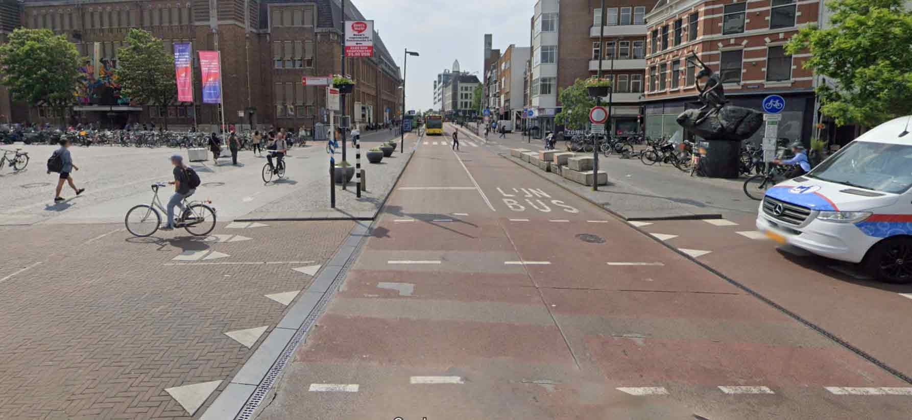
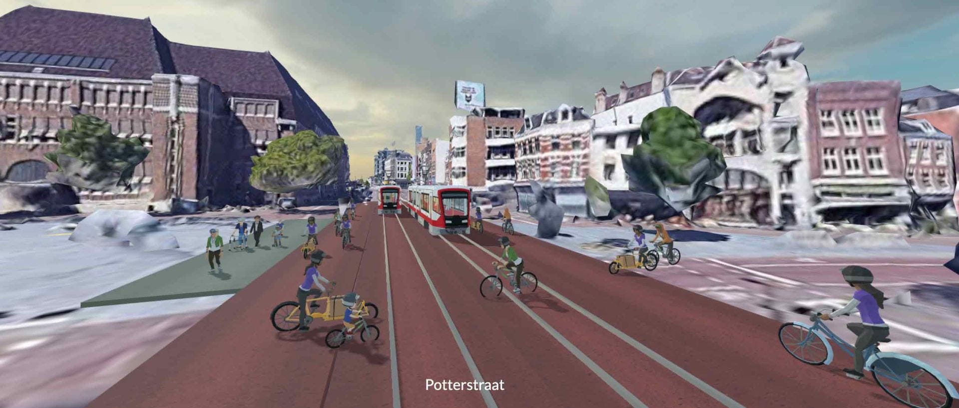
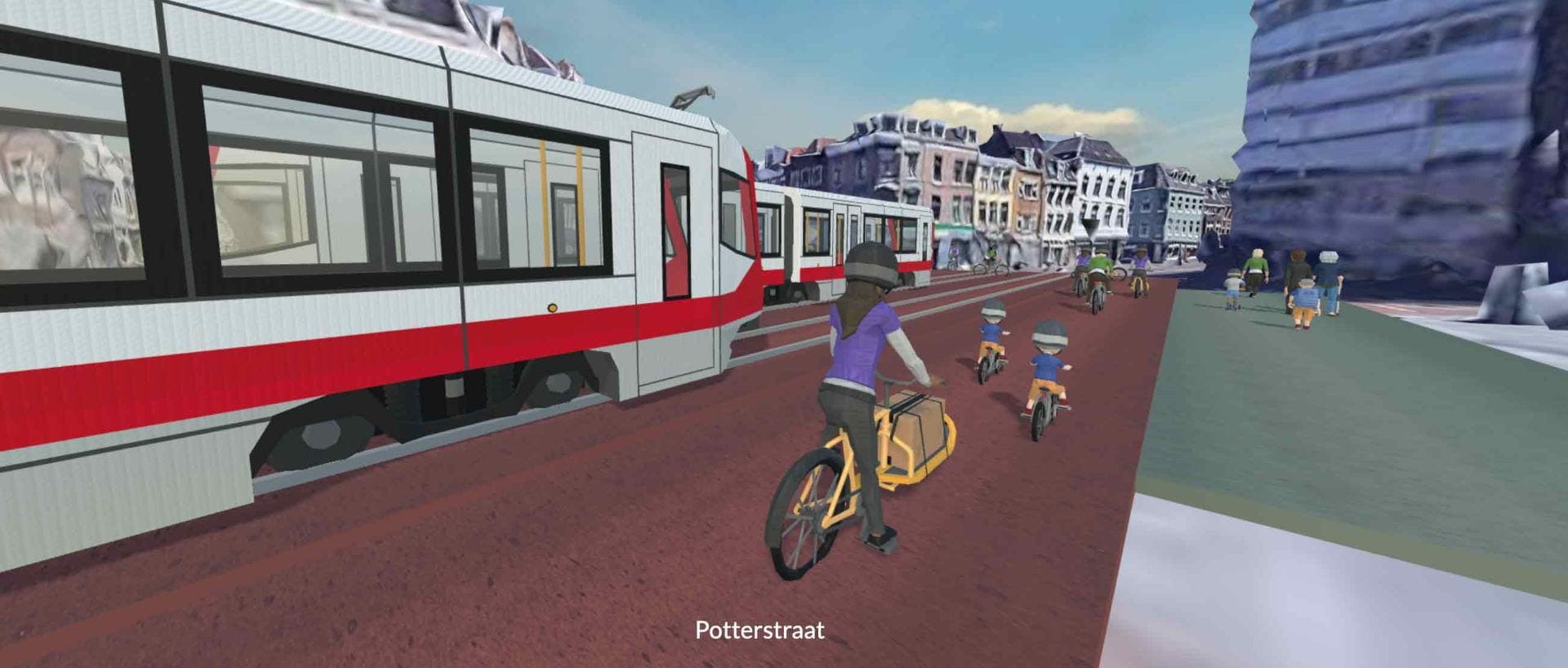
But in the spirit of quick, easy, and valuable visualization, here is a design I made recently – randomly converting Potterstraat in Utrecht (Netherlands), a street with dedicated bus lanes, which forces the street to look like a street, into light rail, which allows the space to be a plaza that more easily mixes people on bike and foot. This took under 20 minutes to create (for me). And if you’ve never been to this exact location, it is a fascinating spot to just watch humanity negotiate ambiguous, shared space from all directions with all ages and with a wide range of bike and vehicle types.