Eugene’s Proposed Redesign of 24th to Improve Safety And Comfort for Cycling
I Like the Direction The City is Going
This is a very Eugene-specific commentary, primarily because a survey is out to get public opinion about a proposed street redesign. At some future post, I will comment on how ludicrous I think it is that many cities ask the public their opinion on specific street designs, street by street, when it comes to making them work better for people on bike or foot. But for now…
There is a currently a city proposal to make modest redesigns of 24th Avenue that make the biking environment safer and more comfortable for more people (especially kids) from Agate to Amazon. The city is soliciting feedback through December 20th, 2024 and you can find out more information and a link to the city survey here. For the record, I’m very supportive of the proposed changes to 24th!
Below is some context, what city staff are proposing, and then some additional visualizations I made for the proposed changes to help more people ‘see’ the proposed design in case imagining such things just in your head isn’t the easiest thing for you.
City Design & Context
The context from the city is straightforward – the 24th Avenue corridor from Amazon to Agate is set for some modest upgrades to improve the safety and comfort for people on bike, and presumably for people crossing 24th on foot or bike, while retaining the same access for people driving. Here are the typical cross sections along 24th.
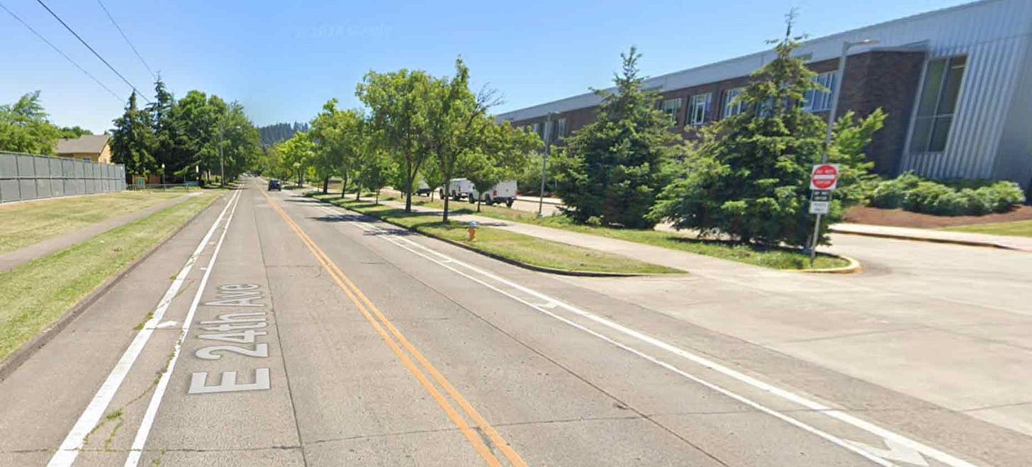
This section is more of a neighborhood area and 24th has unprotected bike lanes on both sides and on-street parking on much of one side. Cars drive much faster than the posted speed limit because the street design is straight, with good sight lines, and the only east-west street in the neighborhood without stop signs every other block. These design features make the street extremely uncomfortable to bike on, even though much of this street is embedded in neighborhoods.
This section of 24th has more institutional uses - a middle school, high school, sports facilities on both sides, a beautiful new YMCA, and a Very Little Theater (its actual name). The street has buffered bike lanes on each side, which offersa bit more space between people on bike and the faster and heavier moving cars and trucks.
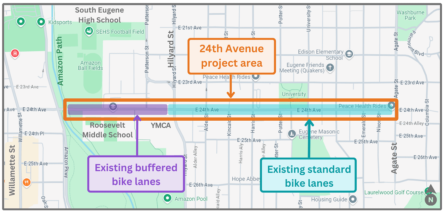
The main proposal is to extend the buffered bike lanes on the section in front of Roosevelt Middle School and the YMCA throughout the whole corridor: Here is the corridor:
And here is a 2D cross-section from the City of the existing and proposed designs:
(Fun fact: you can make this exact type of design or your own version of how to allocate the public land in the street right-of-way using a free, on-line, easy-to-use tool called Streetmix.)
My Extension of the City’s Information
Here are some additional visualizations that I made of the proposed design, but in 3D, including as seen in a more realistic viewpoint by embedding the design into something like Google Streetview.
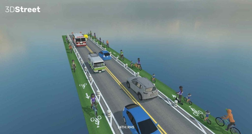
Using a free, web-based, easy-to-use street design tool called 3DStreet, here are two images that show the buffered bike lane with bollard design from two perspectives. This is the basic design that would exist throughout the whole corridor.
And here are those same two images, but placed in front of Roosevelt Middle School with a form of Google Streetview as the background. (Some of the wonky warped shapes are bits and pieces or trees from the Streetview images rhat get all distorted when placed into an actual 3D computer environment.)
And here is a final pair of images that show a before and after:
Look how vibrant and full of people the corridor becomes with this simple design change! Seriously, adding the bollards inside the painted buffer significantly increases the feeling of safety for users – include us parents on behalf of our kids! – in the bike lane by creating one more way to separate them from faster and heavier cars (or a minibus or a firetruck or a tuk-tuk in the images above). And because the bollards are spaced apart, the corridor remains permeable for people on bike or scooter or skateboard, but not permeable for cars, except at appropriate driveways. When using a physical barrier like bollards or a cement curb, that permeability is really important (and a critique of mine on the implementation of some curb-protected bike lanes in town, which generally are not permeable enough). The bollards are relatively low cost compared to laying cement, so are also a good option to create safer conditions on a budget. Upgraded separators can always happen later as demand and budget (and desire for something more attractive) increase.
More info
A few final thoughts:
I hope you like these images and hope that they help you see the proposed redesign;
I will soon make additional posts about 24th that include the following:
I will apply the buffered bike lane with bollard design to additional segments of 24th Avenue just for visualization purposes;
I will include some bonus ideas for the redesign, including some low-cost thoughts about crossing 24th at Alder, Onyx (maybe), and Patterson into / out of the YMCA. I do not know what the overall budget of the project is, so these may be things already under consideration or could be further future upgrades when budget allows.
Parallel streets like 23th and 25th (east of Hilyard) will continue to remain excellent ADDITIONAL east-west routes as they are also flat and have much less car traffic;
A few final final thoughts:
The proposed redesign of 24th is a very appropriate upgrade (and quite modest as well). 24th between Agate and Alder is essentially a neighborhood street that has been turned into a speeding car corridor, so returning to a design that at least makes it safer and more comfortable for people on foot and bike makes logical sense. Aiding in crossing 24th will reconnect the neighborhoods now bisected by 24th. And then the section from Alder to Amazon is so full of family-friendly destinations, that creating a design that allows people of all ages (especially our kids!) get there independently and safely is a worthwhile goal that the proposed project is addressing.
If you want to make 3DStreet designs just like the ones above, you completely can – instructions on the free software and how to do will be in another post.
If you want to see some excellent neighborhood greenway ideas (and more, like an amazing ‘filtering’ concept plan for the neighborhood just north of South Eugene High School) from Univversity of Oregon undergraduate LiveMove students, check out their work here.
Thank you for reading this far. Feel free to leave comments or ideas, though please don’t be nasty as there is too much of that going around already.


